Envoy is now anchored in Soudha Bay, western Crete.
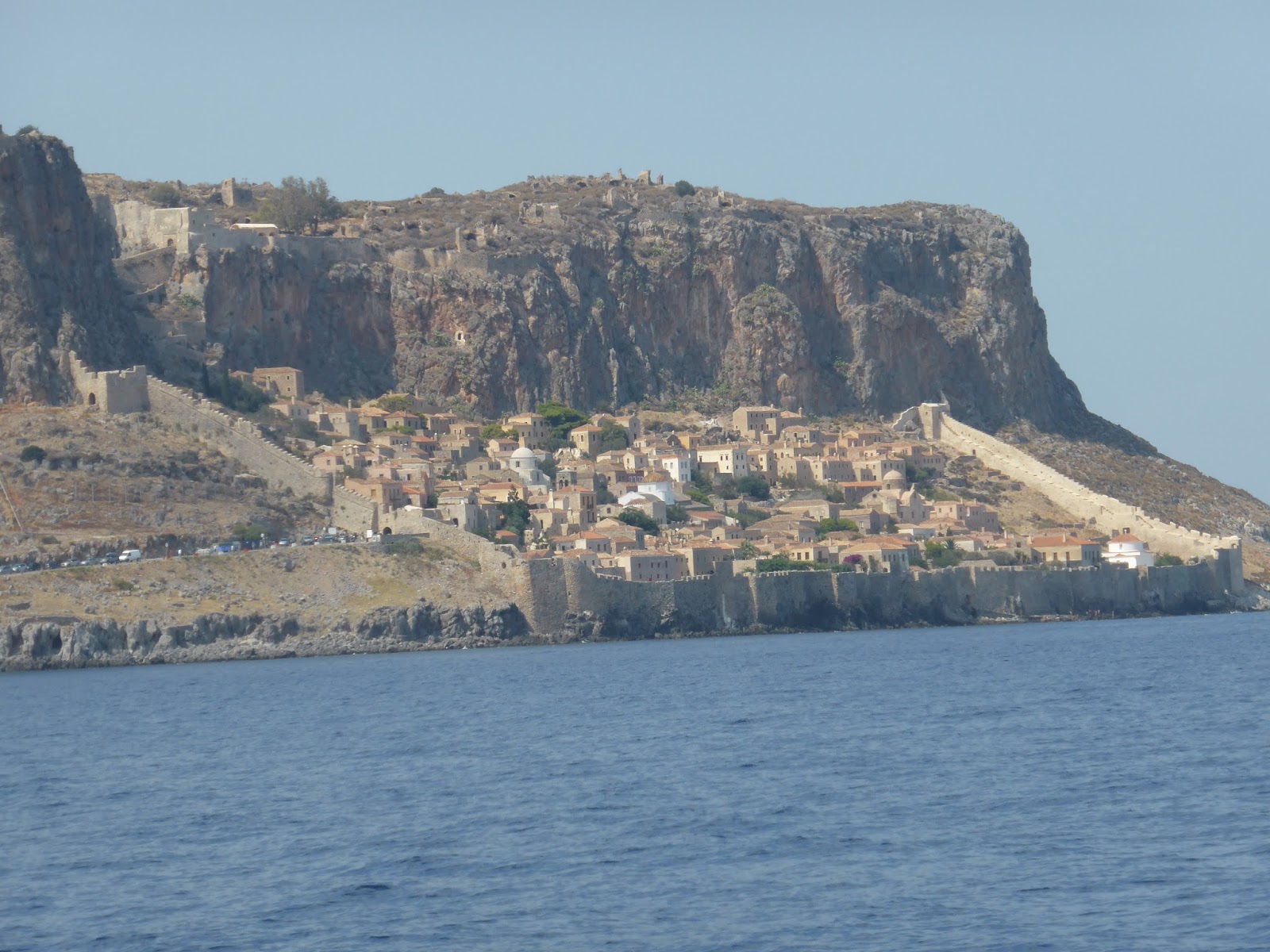
At Monemvasia we're having strong northerlies of 20 knots gusting 30 and the seas outside our reasonably protected area are over two metres and breaking – not what we want for a 60 mile easterly crossing to Milos. But we see an improvement with the wind forecast to be 12-14 knots gusting 20 and seas of about one metre, so having removed our stern lines the night before to aid a speedy departure we leave Monemvasia at 0700 hrs. Thirteen hours later we pull into the welcome shelter of Ormos Provatas on the southern side of Milos Island – our first time here. This is a relatively long trip for us and it was on one course all the way – east with a 1–1.5m breaking sea on our port beam. The Naiad hydraulic stabilisers did their job perfectly and provided a comfortable trip with our roll being mostly about 5 degrees and sometimes 10. On the way we see only one yacht, one fishing boat but several large cargo ships and have to change course to avoid one approaching from starboard. Here's a typical sequence of events when we see a vessel approaching:
-I notice a speck on the starboard horizon and use the binoculars to identify it as a tanker on a converging course
-Activating the radar I see it is 12.3 miles away heading towards us
-I adjust the radar's Electronic Bearing Line (EBL) so that it lies over the tanker and do the same with the Variable Range Marker (VRM)
-The EBL shows the bearing of the tanker from Envoy and if this remains constant we are on a collision course. If the tanker moves ahead of or behind the EBL by a safe distance no course change is needed
-The VRM shows the exact distance from the tanker to us
The approaching tanker in the distance

The tanker shows as a blip on the right side of our radar under the EBL (the white is reflection of camera's flash). Another blip bottom left of radar is a vessel well behind us and not a threat.

The blip has moved ahead of the EBL showing that the tanker will pass safely ahead of Envoy

The tanker as it crosses Envoy's bow at a safe distance of 1.8 miles

This gets to be great fun is at night time with more than one vessel approaching!
Apart from monitoring other shipping we do an hourly check recording engine temperature, oil pressure, battery charging voltage and AC and DC amps being drawn as well as a quick visual inspection of the engine room to detect any unusual smells, leaking hoses, fluids under the engine, suspect vee belts or water in the bilges.
We also took the opportunity of a lengthy cruise to check our fuel consumption and it worked out at just over eight litres per hour running between 1530 and 1640 rpm, but including three hours of generator running as well.
Ormos Provata is a great bay providing near perfect shelter for the next three days from mostly about 20 knots but up to 30 northerly winds. The seas are sufficiently rough that smaller local ferries and day tripper boats are canceled but the bay is well protected from the north and people are enjoying the sandy beach and nearby tavernas. Envoy is anchored about 300m offshore where there's a 200mm wind chop so we take the RHIB ashore for our swims.
When the wind reduces and the seas abate we cruise to the northern side of the island noting that the rugged coastline indented with many sea caves has also been ravaged by both historical and current mining of sulpur, kaolin, alum and barium. In fact the first settlers came here in Neolithic times (7000 BC) in search of glass-like obsidian to make axes, knives and adzes. During the Bronze Age (about 2,800 to 1,100 BC) Milos became a prosperous centre of Cycladic culture. The Byzantines arrived later until the Turks took over in 1566.
But Milos is best known for the 4th century BC armless statue of Aphrodite – the Venus di Milo found by a farmer in an olive grove in 1820 and now in Paris.
Milos is a volcanic island and in a huge bay formed by an eruption in 90,000 BC we anchor outside the marina off the island's main town of Adhamas, a stunning village with typical whitewashed buildings on the bustling taverna-lined seafront, some interesting shops and excellent facilities to re-supply.
Kids sailing around Envoy at anchor off Adhamas

The Adhamas waterfront

Atop some steep hills behind Adhamas sits the Chora offering superb views over the island, although little else of interest compared with other Choras we've visited.
The hilltop Chora above a seaside village


FOR FOODIES
Di and I have become very partial to ice cold coffee Frappes accompnaied by a slice of the delicious cakes which are available from bakeries here

TECHNICAL
Most things are working well. I contact our Greek agent, A1 Yachting, as the RHIB's auxiliary power supply to the depth sounder and VHF radio have failed. Their electrician fixes this in about 15 minutes charging 25 Euros (about NZ$42).
One of our two aircon units has failed, tripping the circuit breaker on powering up. I will need to find some specialised help on this later. We only use the two aircons to provide an electrical load for the generator as the refrigerator and battery charger don't load it up sufficiently.
At Monemvasia we're having strong northerlies of 20 knots gusting 30 and the seas outside our reasonably protected area are over two metres and breaking – not what we want for a 60 mile easterly crossing to Milos. But we see an improvement with the wind forecast to be 12-14 knots gusting 20 and seas of about one metre, so having removed our stern lines the night before to aid a speedy departure we leave Monemvasia at 0700 hrs. Thirteen hours later we pull into the welcome shelter of Ormos Provatas on the southern side of Milos Island – our first time here. This is a relatively long trip for us and it was on one course all the way – east with a 1–1.5m breaking sea on our port beam. The Naiad hydraulic stabilisers did their job perfectly and provided a comfortable trip with our roll being mostly about 5 degrees and sometimes 10. On the way we see only one yacht, one fishing boat but several large cargo ships and have to change course to avoid one approaching from starboard. Here's a typical sequence of events when we see a vessel approaching:
-I notice a speck on the starboard horizon and use the binoculars to identify it as a tanker on a converging course
-Activating the radar I see it is 12.3 miles away heading towards us
-I adjust the radar's Electronic Bearing Line (EBL) so that it lies over the tanker and do the same with the Variable Range Marker (VRM)
-The EBL shows the bearing of the tanker from Envoy and if this remains constant we are on a collision course. If the tanker moves ahead of or behind the EBL by a safe distance no course change is needed
-The VRM shows the exact distance from the tanker to us
The approaching tanker in the distance

The tanker shows as a blip on the right side of our radar under the EBL (the white is reflection of camera's flash). Another blip bottom left of radar is a vessel well behind us and not a threat.

The blip has moved ahead of the EBL showing that the tanker will pass safely ahead of Envoy

The tanker as it crosses Envoy's bow at a safe distance of 1.8 miles

This gets to be great fun is at night time with more than one vessel approaching!
Apart from monitoring other shipping we do an hourly check recording engine temperature, oil pressure, battery charging voltage and AC and DC amps being drawn as well as a quick visual inspection of the engine room to detect any unusual smells, leaking hoses, fluids under the engine, suspect vee belts or water in the bilges.
We also took the opportunity of a lengthy cruise to check our fuel consumption and it worked out at just over eight litres per hour running between 1530 and 1640 rpm, but including three hours of generator running as well.
Ormos Provata is a great bay providing near perfect shelter for the next three days from mostly about 20 knots but up to 30 northerly winds. The seas are sufficiently rough that smaller local ferries and day tripper boats are canceled but the bay is well protected from the north and people are enjoying the sandy beach and nearby tavernas. Envoy is anchored about 300m offshore where there's a 200mm wind chop so we take the RHIB ashore for our swims.
When the wind reduces and the seas abate we cruise to the northern side of the island noting that the rugged coastline indented with many sea caves has also been ravaged by both historical and current mining of sulpur, kaolin, alum and barium. In fact the first settlers came here in Neolithic times (7000 BC) in search of glass-like obsidian to make axes, knives and adzes. During the Bronze Age (about 2,800 to 1,100 BC) Milos became a prosperous centre of Cycladic culture. The Byzantines arrived later until the Turks took over in 1566.
But Milos is best known for the 4th century BC armless statue of Aphrodite – the Venus di Milo found by a farmer in an olive grove in 1820 and now in Paris.
Milos is a volcanic island and in a huge bay formed by an eruption in 90,000 BC we anchor outside the marina off the island's main town of Adhamas, a stunning village with typical whitewashed buildings on the bustling taverna-lined seafront, some interesting shops and excellent facilities to re-supply.
Kids sailing around Envoy at anchor off Adhamas

The Adhamas waterfront

Atop some steep hills behind Adhamas sits the Chora offering superb views over the island, although little else of interest compared with other Choras we've visited.
The hilltop Chora above a seaside village

Close up of very quaint village by the sea

Someone lives in this dwelling built into a sea cave - at least for the holidays

FOR FOODIES
Di and I have become very partial to ice cold coffee Frappes accompnaied by a slice of the delicious cakes which are available from bakeries here

TECHNICAL
Most things are working well. I contact our Greek agent, A1 Yachting, as the RHIB's auxiliary power supply to the depth sounder and VHF radio have failed. Their electrician fixes this in about 15 minutes charging 25 Euros (about NZ$42).
One of our two aircon units has failed, tripping the circuit breaker on powering up. I will need to find some specialised help on this later. We only use the two aircons to provide an electrical load for the generator as the refrigerator and battery charger don't load it up sufficiently.